Home
 Aerial Photo
 Warren Survey Map
 Temple Diagram
 Temple Overlays
 Survey Map Overlays
Triple Gate
 Double Gate
 Water Levels
 Water Channels
 Ophel Excavations
 Fort Antonia
Herodian Stones
 Nehemiah Map
 Temple Courts
 Early Temple
 Wailing wall
 

The Temple Mount in Jerusalem - Temple Diagram
 

Diagram of Solomon & Herod's Temple compound

According to measurements given in the Mishna and the writings of Josephus, and of course the ruins above ground and underground on the Mount itself,  I believe this diagram is very close to the actual layout of the old temple compound.

The GREEN square represents  Solomon's original Temple compound.

The BLUE square represents Herod's enlarged Temple compound when he enlarged the size of the old complex on the North, West, and South before 70 AD 

The RED  square in the middle represents the partition wall (soreg) that no gentile could go beyond, to do so would mean certain death.

To view this diagram superimposed over Warren's map 
Click Here

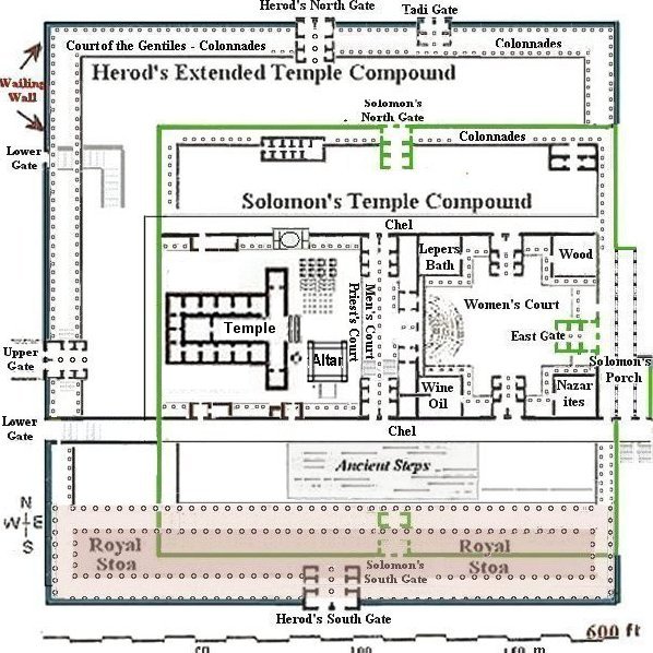
 (Note: Please understand that my drawings are not exact.)
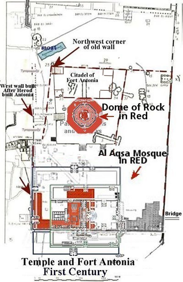
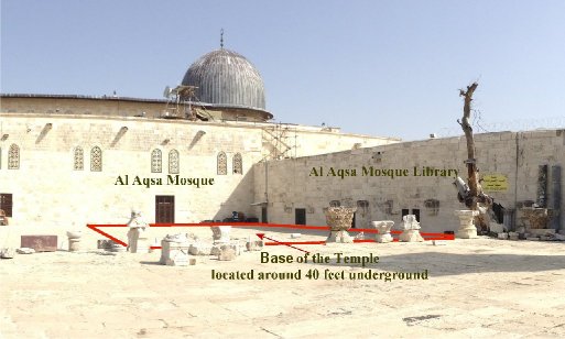
 

Solomon's Temple was restricted by the valleys on the west and east.  Herod did not make any changes in the east gate because it was so beautiful.  The east gate included Solomon's Portico.